Earthquakes in Mexico City: what owners should know
The most destructive earthquakes in Mexico City's history, in September 1985, started on the Pacific coast. The city is also shaken by quakes inside the plate beneath it and on local faults, and much of it stands on the bed of former lakes, whose very soft, compressible deposits with a high water content favor the amplification of seismic waves. Two dates, September 19, 1985 and September 19, 2017, show what that combination can do to buildings.
For an owner who lives somewhere else part of the year, the useful questions come after the history. The alert warns people who are inside; a closed house hears it alone. What protects the house is a building that was designed to the rules, a record of its condition before the quake, and someone who checks it the same day and puts what they find in writing. This guide follows that order: the ground, the two earthquakes, the alert, the code, the sources, and the visit.
Why does Mexico City shake so much?
Because it receives waves from faults far away, and then amplifies them in its soft ground. Mexico lies in a region of high seismicity where five tectonic plates interact: North America, Cocos, Pacific, Rivera and the Caribbean. The Mexican Geological Survey describes the capital as the receiver of the quakes those plates produce, even though it is not on the coast, and explains that they do more damage there because, among other things, of the nature of its ground, built on what was once a lake.
CENAPRED, the national disaster prevention center, lists four kinds of seismic source that affect the city: subduction quakes on the Pacific coast, such as Michoacán in 1985; intraplate quakes inside the Cocos plate, such as Puebla-Morelos in 2017; crustal quakes, such as Acambay in 1912; and quakes on local faults within the basin.
The ground decides the rest. The 1987 building regulation divided the city into three zones: hill ground of rock or generally firm soils, a transition zone, and a lake zone of thick, highly compressible clay deposits, whose combined layers can be more than 50 meters deep. A wave that reaches those clays grows in amplitude. Which of the three zones a house stands on is the first fact worth knowing about it, and the ground under it matters for more than earthquakes, as the guide to living in Mexico City sets out.
What happened in 1985 and in 2017?
Two different earthquakes, on the same date, with different causes. The National Seismological Service catalog records the first at 07:17:49 local time on September 19, 1985, magnitude 8.1, 45 km northwest of La Mira, Michoacán, at a depth of 15 km, on the Pacific coast where the Cocos plate slides beneath North America. A second quake, magnitude 7.6, followed the next evening near Zihuatanejo. In the lake zone the ground moved hard: the maximum acceleration recorded at the SCT station there was 164 gal, where 1 gal is 1 cm/s².
The second struck at 13:14 on September 19, 2017, magnitude 7.1, on the border between Puebla and Morelos. The SSN's special report places it 120 km from Mexico City, on a normal fault typical of an intraplate quake, inside the Cocos plate and more than 50 km down. It was smaller than 1985 and of a different kind, and the buildings it damaged were different too.
CENAPRED's figures for the buildings tell the difference. For 1985 it counts 3,300 buildings damaged and 250 collapsed; for 2017, 46 buildings collapsed and 73,000 constructions damaged, with severe damage in mid-rise reinforced concrete buildings that had walls of unreinforced masonry. A third strong quake came on the same date in 2022: the SSN catalog records magnitude 7.7 on September 19, 2022, south of Coalcomán, Michoacán.
What changed after each of them?
The rules for buildings changed first, then the instruments, then the alert. Most of what an owner deals with today, from the structural engineer's signature to the sound on the street, dates from the years after 1985. The table follows the changes in order, each with its source.
| Year | What happened | What it changed |
|---|---|---|
| 1957 | Emergency rules after damage to buildings on soft ground | The design seismic force depended on the type of soil for the first time |
| 1985 | Emergency construction norms, October 18 | Owners had to report damage to structures and walls, and obtain a technical opinion reviewed by the authority |
| 1986 | CIRES founded in June | A nonprofit dedicated to seismic instrumentation, later the operator of the alert |
| 1987 | New building regulation, July 3, citing the 1985 quakes | Buildings grouped by importance, ground divided into three zones, a structural safety certificate for essential buildings |
| 1987 | Mexico City accelerograph network (RACM) | Recorded ground motion that feeds the design factors of the city's technical norms |
| 1991 | Seismic alert system for Mexico City in operation | Warning seconds before the shaking of a strong coastal quake reaches the city |
| 2012 | SASMEX formed, with 96 sensors | Coverage of the coasts of Jalisco, Colima, Michoacán, Guerrero and Oaxaca, and of Puebla |
| 2015 | Alert over the city's C5 loudspeakers from September 19 | The official sound in the street, not only on radio and television |
| 2025 | Cell broadcast alert in the national drill, September 19 | The alert reached millions of mobile phones across the country |
Read as a whole, the table shows rules that moved after damage. A 2021 CENAPRED review says that building regulations in Mexico have evolved mainly in reaction to the damage observed in earthquakes, and that Mexico City's is probably the most refined in the country.
How does the seismic alert work?
It detects a quake that has already begun and sends a signal by radio waves, which travel faster than seismic waves. The Mexican Seismic Alert System, SASMEX, is operated by CIRES, not by the National Seismological Service. Its sensors run along the Pacific subduction zone, estimate the size of a quake in the first seconds, and each city decides from that estimate and the distance whether to sound the alert.
CIRES publishes the criteria. The alert sounds in a city when at least two stations exceed a preset energy level and the estimated quake is above magnitude 5 within 200 km, above 5.5 within 350 km, or above 6 beyond 350 km. It gives roughly 20 to 120 seconds of warning, depending on the distance to the epicenter; for a quake on the Michoacán coast, more than 100 seconds in Mexico City. The sound lasts one minute in the city and is broadcast on most radio and television stations, through the C5 loudspeakers and on dedicated receivers.
Its limits are part of how it works. A quake that occurs far from the detection coverage, too far from the city, or below the energy thresholds does not warrant an alert, and CIRES warns that apps depending on an internet connection arrive with variable delays. The closer the quake is to the city, the shorter the warning. No technique, the SSN states, can determine when or where an earthquake will occur: the alert announces a quake, it does not predict one.
For a house that is closed, the alert changes nothing during the shaking. It matters to the staff, the building's doorman or the neighbors who are there. What the owner can use is the fact that a quake set off the alert, because that is the clearest sign that the house should be checked the same day.
What do building codes ask of a house or an apartment?
They ask it to stand up to the quakes of its zone without failing, and they ask more of buildings that matter more. The regulation of 1987, written after the 1985 quakes, placed hospitals, schools, stadiums, fuel stations and similar buildings in Group A, and ordinary buildings for housing, offices and shops in Group B, with a subgroup B1 for taller or larger buildings: more than 15 meters in height in the lake zone, more than 30 meters in zones I and II.
The zone set the force. The same regulation fixed the seismic coefficient for Group B buildings at 0.16 in zone I, 0.32 in zone II and 0.40 in zone III, raised by half for Group A. Outside the simplified method that the technical norms set for smaller buildings, a building on the old lake bed was designed for two and a half times the lateral force of the same building on the hills. Every structure also had to have adequate safety against every possible failure under the most unfavorable combination of loads in its expected life.
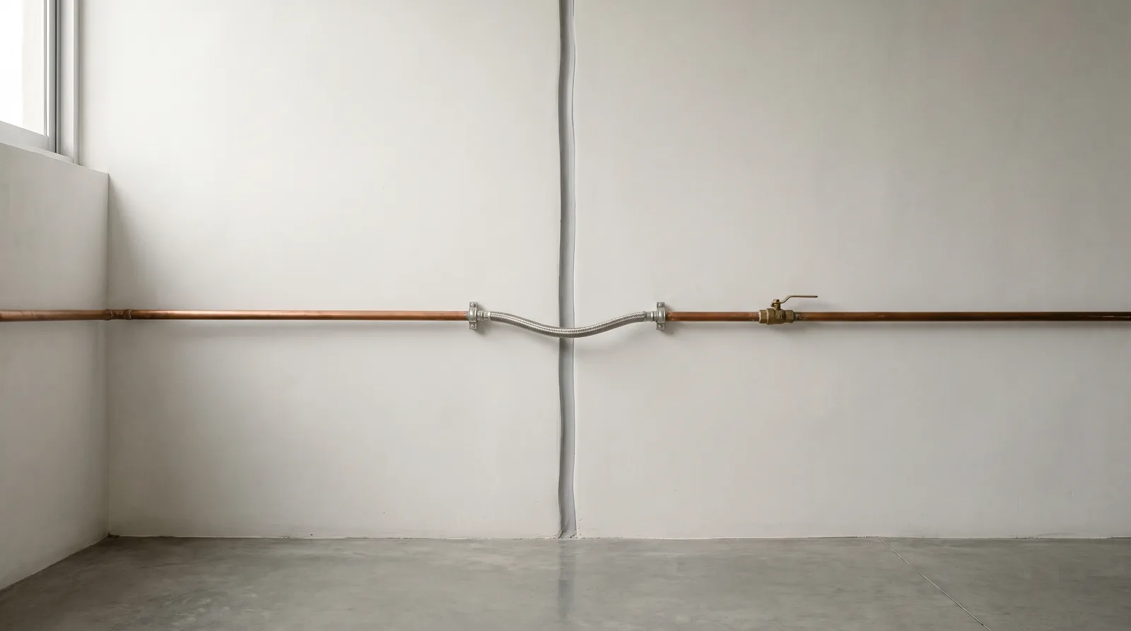
Several of its rules reach into an ordinary house. A building had to keep a gap from its neighbors, and the spaces between neighboring buildings and the construction joints had to stay free of any obstruction. Gas, water and drainage pipes could not cross a construction joint without flexible connections, and heavy finishes such as stone facings and plaster ceilings had to be fixed by approved methods. Group A buildings had to register a structural safety certificate, renewed every five years or after each strong earthquake.
The 1987 text is the historical one. The rules in force, as CENAPRED's structural risk office summarized them in 2020, keep the same pieces: a structural safety certificate every five years or after a quake when the authority so decides, a structural opinion that the owner requests when there is doubt about a building, usually after a strong quake, and a structural engineer registered as Corresponsable en Seguridad Estructural who signs both.
Which official sources report a quake?
Three institutions, each with its own job. The National Seismological Service, part of UNAM, reports the date and time of origin, the magnitude, the coordinates of the epicenter, a nearby locality and the depth. Its first magnitude comes from a small group of stations and is recalculated as more data arrive, so a first figure can change. In 2017 the SSN reported an average of 40 earthquakes a day across the country.
CIRES publishes whether SASMEX sounded the alert for a given quake, or whether it did not warrant an alert in Mexico City. CENAPRED and the civil protection authorities publish what to do before, during and after, and CENAPRED asks people not to spread rumors and to follow the authorities' recommendations.
One distinction helps an owner read the reports. The magnitude measures the energy of the quake. The intensity is assigned according to the damage or effects on people and their buildings, and the SSN notes that the shaking felt in a place depends on the distance to the epicenter, the type of ground and the type of construction. The same magnitude can mean very different things for a house on firm ground and one on the old lake bed.
What is checked after a quake when the owner is away?
The house is checked the same day, against the record of how it was before. CENAPRED's first recommendation after a quake is to check the house, and not to light matches or candles until there is no gas leak, and to expect aftershocks. For a house nobody is living in, that means a visit by someone with keys and a list.
The crack is the item that needs judgment. CENAPRED's structural risk office explains that the level of damage depends on a crack's width and direction, and treats as significant a diagonal crack about 1 mm wide in concrete or 3 mm in masonry. A visit records it; it does not decide what it means. That opinion belongs to a structural engineer, and civil protection staff cannot issue it.
The rules put the responsibility on the owner. The 1987 regulation obliged every owner to report to the authority the damage they know of, including damage caused by an earthquake, and to obtain a stability and safety opinion from a Corresponsable en Seguridad Estructural if the building was damaged. CENAPRED notes that the current regulation still requires any anomaly or damage to be registered with the local authority, and that the safety of a building is mainly its owner's responsibility. An owner who is away meets that duty through someone who goes to the house and writes down what they find.
Most of the work happens before the quake: a dated record of cracks, a gas installation with its valve and flexible connections in order, finishes that are fixed. It is the same kind of dated routine that the guide to Mexico City weather describes for the roof before the rains. What that role looks like day to day is in the guide to what a property manager does. Keeping that record and running the visit after a quake is part of preventive maintenance.
Why does Mexico City shake so much in an earthquake?
Much of the city stands on the bed of former lakes, whose soft, compressible, water-rich deposits amplify seismic waves. It also receives quakes from several sources, from the Pacific subduction zone to the interior of the Cocos plate, as CENAPRED lists them.
What happened in the 1985 and 2017 Mexico City earthquakes?
On September 19, 1985 a magnitude 8.1 subduction quake struck on the coast of Michoacán, and on September 19, 2017 a magnitude 7.1 intraplate quake struck on the Puebla-Morelos border, about 120 km from the city. CENAPRED counts 250 buildings collapsed in 1985 and 46 in 2017, in a 2021 review of building rules.
Does the seismic alert sound for every earthquake in Mexico City?
No. SASMEX, operated by CIRES, sounds only when a quake in its coverage area is estimated above set magnitudes for its distance from the city, and a quake outside that area does not warrant an alert.
Who reports an earthquake in Mexico?
The National Seismological Service of UNAM reports the time, magnitude, epicenter and depth, and updates the magnitude as more data arrive. CIRES reports whether the alert sounded, and the SSN operates no alert.
What should be checked in a house after an earthquake?
Gas first, then water, cracks against the previous record, doors and windows that stick, and heavy finishes; CENAPRED asks people to check the house and not light a flame until there is no gas leak. If there is damage, the structural opinion belongs to a Corresponsable en Seguridad Estructural.